We explain what the Andes mountain range is, its characteristics and location. Also, how it was formed and what its flora and fauna are like.
What is the Andes mountain range?
The Andes mountain range It is a mountain formation that crosses South America from western Venezuela to the island of Tierra del Fuego and that is part of the geology of the so-called Pacific Ring of Fire. It is made up of a series of elevated plains and even higher peaks, among which are the highest volcanoes in the Western Hemisphere.
Its name comes from the word anti of the Quechua language, with which the Inca peoples of the region called the geographical east. According to the Inca Garcilaso de la Vega (1539-1616), in the ancient Inca empire (called Tahuantinsuyowhich means “the four corners of the Earth”) was called antisuyu to the eastern province of the empire and anti to the snowy mountain range that crossed it.
The Andes mountain range is not completely homogeneous, but rather comprises several sets of valleys, plains and peaks, throughout three geographically differentiated regions, which are:
The northern Andes. They extend from the Barquisimeto-Carora depression in western Venezuela to the Pasco node or Bombón plateau in Peru. This set, in turn, is divided into three mountain ranges:
- The eastern mountain range It begins in Venezuela and ends in southern Colombia, and on the border between both countries it branches into the Mérida mountain range and the Serranía del Perijá.
- The central mountain range separated from the eastern mountain range by about 400 km, is located entirely in Colombia, from the Almaguer knot or Colombian massif, to the San Lucas mountain range. The Cauca and Magdalena rivers border it to the west and east respectively.
- The western mountain range It extends southeast from the Pastos node, in Colombia, to the Paramillo node, where it branches into various mountain ranges: Ayapel, San Jerónimo and Abibe. This mountain range constitutes a single block of mountains with the northeastern region of Ecuador.
The central Andes. They extend from Peruvian territory to the snowy Tres Cruces, on the border between Chile and Argentina. It is the largest region of the entire orographic complex, with a constant and continuous elevation, without mountain passes below 4,000 meters high. Upon entering Bolivian territory, the Andes of this region branch into two different mountain ranges, in the middle of which is the Bolivian altiplano:
- The western or volcanic mountain range characterized by the presence of volcanoes, extends from the Jucuri knot to the Licancabur volcano, and acts as a natural border between Bolivia and Chile.
- The central or royal mountain range It extends from the snow-capped Chaupi Orco in northern Bolivia to the Zapaleri hill between Bolivia, Chile and Argentina. In this region there are many glaciers, peaks of more than 6,000 meters and high snow.
The southern or southern Andes. They extend from Tres Cruces Hill to Tierra del Fuego, along the Patagonia of the Southern Cone, serving as a natural border between Chile and Argentina. Throughout its journey, it branches into three subregions, which are:
- The arid Andes They extend to Paso de Pino Inchado, in the south-central part of the mountain range, and present high and important peaks, such as Aconcagua, as well as dry, difficult and steep passes, neighboring the Atacama desert region.
- The Patagonian Andes They extend south of Paso de Pino Inchado and present a marked decrease in elevations, due to the erosive action of the glaciers in the region and the tectonic subduction of the plates. It presents high Patagonian forests and numerous mountain passes that allow the passage of the humid Pacific wind. Lakes, glaciers and volcanoes also abound.
- The Fuegian Andes They are the continuation of the mountain range in Tierra del Fuego, in the southern sector of Chile and Argentina. They are located immediately south of the Strait of Magellan, extending to the Island of States, in Argentine territory.
Where is the Andes mountain range located?

The Andean mountain range is located in South America. There it covers a good part of the region, from Venezuela to Tierra del Fuego, bordering the Pacific coast of the continent. On its journey, it crosses the territories of seven countries: Venezuela, Colombia, Ecuador, Peru, Bolivia, Chile and Argentina.
How was the Andes mountain range formed?
The Andes mountain range It was formed in the Mesozoic era specifically in the late Cretaceous period (between 100.5 and 66 million years ago), due to the convergence of two tectonic plates: the Nazca plate and the South American plate. The mountain range is part of the so-called Pacific Ring of Fire, as evidenced by the presence of important volcanoes along its route, especially in the Colombian-Ecuadorian, Bolivian and Chilean regions.
Characteristics of the Andes mountain range

The general characteristics of the Andes mountain range are:
- It extends over 8,500 kilometers, crossing the territory of seven countries. Its width ranges between 250 and 750 kilometers, and it occupies an approximate area of 2,870,000 km.2.
- It is the main mountain range of South America the largest of the five continents and is home to the highest volcanoes on the planet, which are part of the Pacific Ring of Fire.
- Its average height ranges between 3000 and 5000 meters high but it has numerous peaks that exceed that measurement. Its three highest points are Aconcagua (in Argentina) with 6962 meters high, Nevado Ojos del Salado (between Chile and Argentina) with 6891 meters high and Mount Pissis (Argentina) with 6795 meters high.
- It began to form between 450 and 250 million years ago through the accumulation of sediments from the Brazilian massif, producing a depression in the Earth's crust that, 170 million years ago, began to rise due to the subsumption of the Nazca plate beneath the South American plate.
- There is evidence of human presence in the region for at least 12,000 years shortly after the arrival of humans to the American continent. Currently the largest cities located in the Andean mountain range are Bogotá and Medellín (Colombia), Santiago (Chile) and La Paz (Bolivia).
Flora and fauna of the Andes mountain range

Life in the Andes mountain range varies depending on the height and humidity of each subregion of the mountain range. In those higher and drier regions, the presence of plants is a minority grasslands and small shrubs predominate, creeping dicotyledons and trees are scarce.
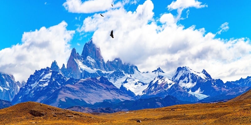
As for the local fauna, There are different important endemic species, such as camelids (guanacos, llamas or vicuñas) and the Andean condor currently at risk of extinction, unique in these regions and famous for its large size. There are also predators such as the puma and the red fox, and good-sized prey such as the vizcacha. There are endemic birds and insects, especially butterflies. Besides, Towards lake regions and wetlands, biodiversity increases considerably.
Continue with: Peruvian jungle
References
- “Annex: Mountains of the Andes mountain range” in Wikipedia.
- “Andean Orogeny” in Wikipedia.
- “What is the Andes mountain range” at the University of Buenos Aires (Argentina).
- “Andes Mountains (mountain system, South America)” in The Encyclopaedia Britannica.


